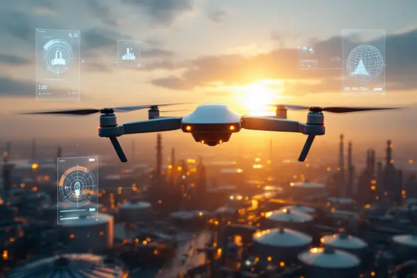
It’s barely 7 a.m. at a refinery in southern Texas, but a Skydio X2 is already slicing through the morning haze. Hovering 40 meters above a distillation tower, the drone’s thermal camera spots an unusual heat signature. Its onboard AI analyzes the anomaly, cross-checks it against historical data, and sends an alert with precise GPS coordinates. By the time the maintenance team arrives, a full intervention plan is ready.
This is how AI-driven drones are transforming inspections—from labor-intensive, high-risk operations into fast, data-rich, and intelligent processes.
1. From Binoculars to Bytecode: A Brief History of Drone Inspections
For decades, industrial inspections relied on scaffolding, rope access, or even helicopters. These methods were not only expensive and hazardous but also produced limited and often low-resolution data.
The first wave of change came in the 2010s, with commercial drones equipped with HD cameras. These replaced many visual inspections, improving coverage and reducing risk—but they still required skilled pilots and hours of manual image review.
The real breakthrough came with embedded AI: algorithms capable of detecting hairline cracks, pattern deviations, and generating reports autonomously. Companies like Skydio, Flyability, and Shield AI led the way by integrating advanced sensors and computer vision into self-flying drones [4], [5], [15].
2. Inside the Tech: LiDAR, SLAM, Sensor Fusion, and Real-Time AI
Inspecting a bridge, wind turbine, or chemical reactor is like playing “Where’s Waldo?”—only now with an automated magnifying glass.
That magnifier is computer vision. Today’s drones, such as the Skydio X10 or Flyability’s Elios 3, combine:
- LiDAR (Light Detection and Ranging): Scans surfaces to create precise 3D models, even in low-light or smoky environments [7].
- SLAM (Simultaneous Localization and Mapping): Enables real-time autonomous navigation in complex areas like confined tanks or industrial corridors [5].
- DroneDeploy + AI: Automates mission planning, captures georeferenced data, and uses pre-trained models to detect corrosion, cracks, leaks, or overheating [8].
In addition, these systems rely on sensor fusion—combining IMU, GPS, RGB, and thermal data—to enhance positional accuracy and data reliability.
Each flight becomes a predictive analysis session, replacing manual hours with faster and more accurate diagnostics.
3. Real-World Impact: Where AI Is Already Changing the Game
Wind Turbines in the Midwest
The META-aivi platform, embedded in autonomous drones, inspects wind turbine blades in minutes. The system identifies micro-cracks, logs their location, and recommends the best intervention. Compared to traditional manual inspections, this reduced analysis time by more than 60% [13].
Bridges on the West Coast
Engineers used computer vision-equipped drones to inspect expansion joints in California’s steel bridges. Thanks to DroneDeploy integration, they identified potential fatigue risks without halting traffic—and exported actionable maintenance reports directly from the dashboard [8].
Chemical and Energy Industries
A major chemical company used the Elios 3 to inspect confined tanks—reducing the inspection time from four days to just six hours. The LiDAR and embedded AI ensured precise measurements while eliminating worker exposure to toxic environments [15].
4. Remaining Challenges: What’s Still on the Radar
Despite the progress, some challenges remain:
- FAA Regulations: Autonomous drone operations in urban and critical infrastructure zones require FAA approval. BVLOS (Beyond Visual Line of Sight) waivers are essential for true remote operations—and still difficult to obtain [9].
- Data Privacy and Ethics: Sensitive sectors like petrochemicals and nuclear energy require clear protocols for image capture and access control [5].
- Extreme Environments: High temperatures, electromagnetic interference, and dense metal structures can disrupt sensors and onboard computing [7].
- Support Infrastructure: Secure networks, cloud storage, and integration with legacy systems can significantly increase upfront costs [6].
Still, the trend is clear: as regulation evolves and costs drop, autonomous drones are becoming central players in industrial inspection workflows.
5. Hands-On Tutorial: Setting Up a Skydio X2 with DroneDeploy
Thinking of trying a real AI-driven inspection mission? Follow these steps:
1. Choose the right drone
The Skydio X2 offers robust obstacle avoidance and native integration with DroneDeploy.
2. Plan the mission in DroneDeploy
- Import site blueprints
- Define altitudes and inspection zones
- Select analysis type (thermal, RGB, LiDAR)
3. Configure the sensors
- Calibrate RGB or thermal cameras
- Enable SLAM mode for confined or GPS-denied environments
4. Execute the autonomous flight
The drone follows the pre-programmed path. Onboard AI avoids collisions and logs georeferenced data in real-time.
5. Analyze the data with AI
On the DroneDeploy dashboard, view automatically flagged anomalies and export PDF reports for technicians.
This entire workflow takes under two hours—and replaces days of traditional manual inspection work.
6. What’s Next: Looking Beyond the Horizon
In the coming years, we’ll likely see autonomous drones integrated with Industrial IoT. Imagine smart valves or motors triggering drone inspections automatically after detecting abnormal conditions.
Another frontier is the use of generative AI to translate drone data into natural language insights. Picture a technician asking, “What’s the corrosion history on valve 7?” and getting a full AI-generated summary—based on thermal images, inspection videos, and maintenance logs.
With 5G infrastructure expansion and better battery technology, drones could soon operate continuously, extending their reach into agriculture, rail transport, and water utilities.
References
[4] Flypix.ai, “Biggest Drone Companies,” Flypix, 2024. [Online]. Available: https://flypix.ai/blog/biggest-drone-companies/
[5] Flypix.ai, “AI Drone Companies,” Flypix, 2024. [Online]. Available: https://flypix.ai/blog/ai-drone-companies/
[6] Flypix.ai, “Drone Data Analytics Software and AI Tools,” Flypix, 2024. [Online]. Available: https://flypix.ai/blog/drone-data-analytics-software-ai-tools/
[7] XD4 Solutions, “The Role of Elios 3 in Industry 4.0,” XD4 Solutions, 2024. [Online]. Available: https://xd4solutions.com.br/pt/o-papel-do-elios-3-na-industria-4-0-drones-e-a-transformacao-digital/
[8] Flypix.ai, “Drone Data Analytics AI Companies,” Flypix, 2024. [Online]. Available: https://flypix.ai/blog/drone-data-analytics-ai-companies/
[9] FAA, “Skydio Approved for BVLOS Operations,” FAA Newsroom, 2023. [Online]. Available: https://www.faa.gov/newsroom/skydio-bvlos-approval
[13] Solomon 3D, “Case Study: Wind Turbine Inspections with META-aivi,” Solomon 3D, 2024. [Online]. Available: https://www.solomon-3d.com/case-studies/meta-aivi/wind-turbine-inspection-drones-ai/
[15] XD4 Solutions, “Drone Inspections in the Chemical Industry,” XD4 Solutions, 2024. [Online]. Available: https://xd4solutions.com.br/drones-inspecoes-industria-quimica/
Deixe um comentário